-
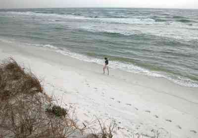
Dunes at the end of the island rise high above the waves.
-
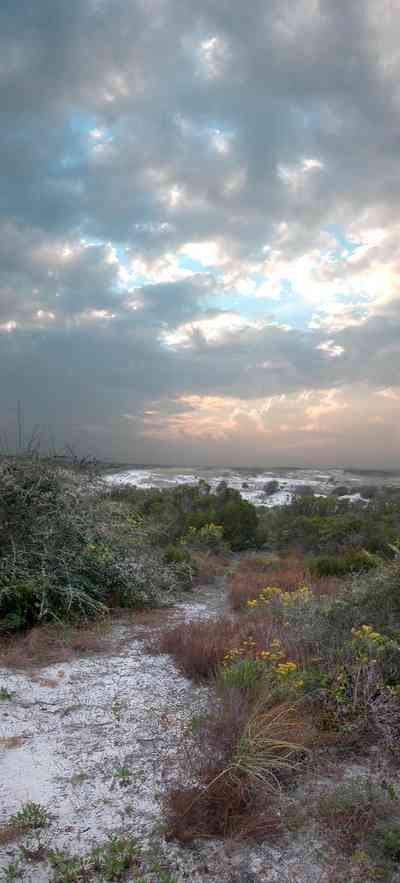
The yellow flowering plants in the foreground are Woody Goldenrod (Chrysoma pauciflosculosa) of the Sunflower Family. (source: Searcy, Darryl. Botanist)
-

The yellow flowering plants in the foreground are Woody Goldenrod (Chrysoma pauciflosculosa) of the Sunflower Family. (source: Searcy, Darryl. Botanist)
-
The yellow flowering plants in the foreground are Woody Goldenrod (Chrysoma pauciflosculosa) of the Sunflower Family. (source: Searcy, Darryl. Botanist)
-
The yellow flowering plants in the foreground are Woody Goldenrod (Chrysoma pauciflosculosa) of the Sunflower Family. (source: Searcy, Darryl. Botanist)
-

The yellow flowering plants in the foreground are Woody Goldenrod (Chrysoma pauciflosculosa) of the Sunflower Family. (source: Searcy, Darryl. Botanist)
-

The lake is bordered by sand dunes and marsh grass. It is located about 2 miles from the main gate of Fort Pickens on the north side of the road.
-
-
-

The beach road bisects Santa Rosa Island.
-
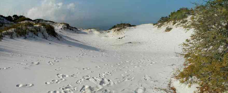
The dunes form undulating ridges along the north side of the beach road. This area is across the road from Parking Lot 10 at the Gulf Islands National Seashore.
-
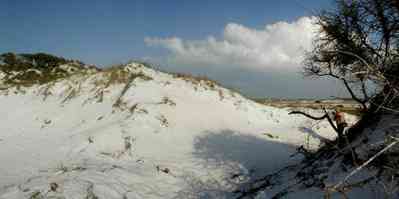
Sparse vegetation holds the dunes in place.
-

Some of dune formations on the north side of the beach road rise to a height of about 30 feet.
-
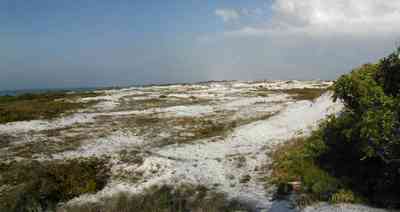
The Gulf can be seen on the far right of the photograph.
-
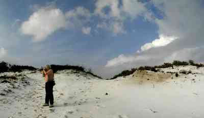
Beach grasses have long roots that form a subsurface net, keeping the dunes from disintegrating.
-
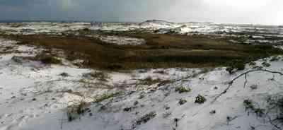
Beach elder accumulates sand rapidly and produces low rounded dunes.
-
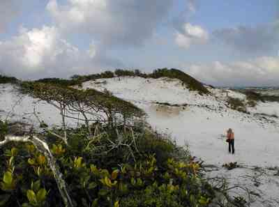
Beach elder (Iva imbricata) has sparse, woody, upright stems and fleshy narrow bright green leaves. Small lavender flowers occur in late summer.
-
-
-

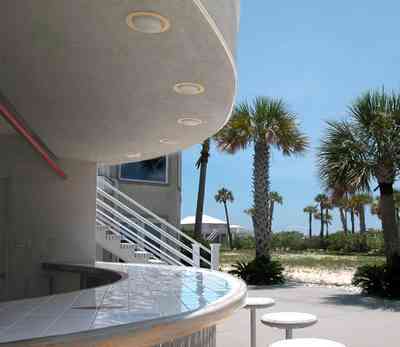
The bandshell is the site of concerts and events throughout the year.
-

The boardwalk area adjacent to the bandshell features small shops and restaurants.
-

The road bisects Santa Rosa Island.
-

The large dunes are located on the soundside or northside of the island.
-
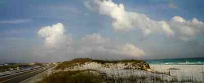
The sparse vegetation has extensive root systems that hold the dunes in place.
-

Emerald water on the right of the photograph is on the gulf side of the island.
-
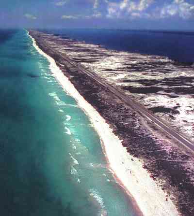
This aerial shows the road that goes the length of Santa Rosa Island. All beach areas can be reached by road, but the road can't be seen from the water.
-

A two lane road runs through the middle of the island.
-
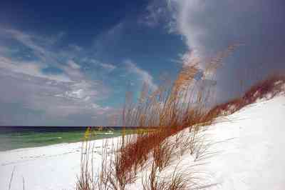
Coastal dunes are formed when sand is trapped around the stems, leaves and roots of plants in the vegetated areas of the beach.
-
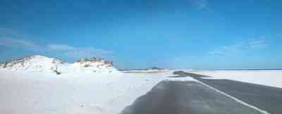
There are few large dunes along the gulf side.
-

Repairs to J. Earle Bowden Way, the 12-mile road through Gulf Islands National Seashore connecting Navarre Beach and Pensacola Beach, are complete. The route is clear and open for the first time since July 2005, when Hurricane Dennis destroyed recently completed repairs from 2004’s Hurricane Ivan.

 Dunes at the end of the island rise high above the waves.
 The yellow flowering plants in the foreground are Woody Goldenrod (Chrysoma pauciflosculosa) of the Sunflower Family. (source: Searcy, Darryl. Botanist)
 The yellow flowering plants in the foreground are Woody Goldenrod (Chrysoma pauciflosculosa) of the Sunflower Family. (source: Searcy, Darryl. Botanist)
 The yellow flowering plants in the foreground are Woody Goldenrod (Chrysoma pauciflosculosa) of the Sunflower Family. (source: Searcy, Darryl. Botanist)
 The yellow flowering plants in the foreground are Woody Goldenrod (Chrysoma pauciflosculosa) of the Sunflower Family. (source: Searcy, Darryl. Botanist)
 The yellow flowering plants in the foreground are Woody Goldenrod (Chrysoma pauciflosculosa) of the Sunflower Family. (source: Searcy, Darryl. Botanist)
 The lake is bordered by sand dunes and marsh grass. It is located about 2 miles from the main gate of Fort Pickens on the north side of the road.

 The beach road bisects Santa Rosa Island.
 The dunes form undulating ridges along the north side of the beach road. This area is across the road from Parking Lot 10 at the Gulf Islands National Seashore.
 Sparse vegetation holds the dunes in place.
 Some of dune formations on the north side of the beach road rise to a height of about 30 feet.
 The Gulf can be seen on the far right of the photograph.
 Beach grasses have long roots that form a subsurface net, keeping the dunes from disintegrating.
 Beach elder accumulates sand rapidly and produces low rounded dunes.
 Beach elder (Iva imbricata) has sparse, woody, upright stems and fleshy narrow bright green leaves. Small lavender flowers occur in late summer.

 The bandshell is the site of concerts and events throughout the year.
 The boardwalk area adjacent to the bandshell features small shops and restaurants.
 The road bisects Santa Rosa Island.
 The large dunes are located on the soundside or northside of the island.
 The sparse vegetation has extensive root systems that hold the dunes in place.
 Emerald water on the right of the photograph is on the gulf side of the island.
 This aerial shows the road that goes the length of Santa Rosa Island. All beach areas can be reached by road, but the road can't be seen from the water.
 A two lane road runs through the middle of the island.
 Coastal dunes are formed when sand is trapped around the stems, leaves and roots of plants in the vegetated areas of the beach.
 There are few large dunes along the gulf side.
 Repairs to J. Earle Bowden Way, the 12-mile road through Gulf Islands National Seashore connecting Navarre Beach and Pensacola Beach, are complete. The route is clear and open for the first time since July 2005, when Hurricane Dennis destroyed recently completed repairs from 2004’s Hurricane Ivan.
 One Tank of Gas